SkyTrack IMSI Catcher
SkyTrack Drone-Mounted Cellular Intelligence & Tracking System
The SkyTrack Drone-Mounted Cellular Intelligence & Tracking System is an advanced airborne tactical solution designed to search, track, and precisely locate mobile phones by identifying their unique International Mobile Subscriber Identity (IMSI) numbers. By combining cell-site emulation with the mobility of professional unmanned aerial vehicles (UAVs), this tactical payload provides defense, law enforcement, and search and rescue (SAR) teams with an elite aerial reconnaissance tool that operates independently of commercial network infrastructure.
Tactical Operational Methodology
The SkyTrack payload operates as a localized, high-efficiency aerial cellular base station. When deployed over a target area, it creates a tactical cell environment that encourages target mobile devices to register with the drone platform.
• Interception and Identification: The system automatically captures the unique IMSI and IMEI identifiers of all active mobile phones in its operational radius.
• Geolocational Pinpointing: By combining signal strength analytics with the drone's onboard GPS/BDS navigation data, the system calculates the exact geographical coordinates of the target.
• Real-Time Filtering: Collected data is instantly cross-referenced against customizable Whitelists and Blacklists to trigger automatic tactical alerts when a target device is acquired.
Technical Specifications and Capabilities
• Full-Spectrum Network Support: Fully compatible with all global telecommunication standards, including Legacy GSM (2G), UMTS (3G), LTE (4G), and Next-Gen 5G networks.
• Seamless Gimbal Integration: Engineered as a quick-release tactical payload explicitly compatible with enterprise drone platforms (e.g., DJI Matrice 300/350 RTK), allowing for deployment ready-to-fly in seconds.
• Extended Operational Range: Utilizes the drone's native long-range data transmission links to allow ground operators to control and monitor the payload from up to 15 kilometers away.
• Extreme Penetration Performance: Detects and tracks mobile devices from an airborne altitude of up to 200 meters, with the radio frequency capability to penetrate up to 6 meters underground or through dense structural concrete.
• High-Density Mass Processing: Features high-throughput processing architecture capable of harvesting and logging data from up to 400 terminal devices per minute.
• Pinpoint Sub-Meter Accuracy: Achieves a highly precise localized location boundary of up to 10 meters when operating independently, which refines to less than 1 meter when synchronized with ground-based hand-held direction finders.
• Dual Software-Defined Radios: Equipped with two independent, software-defined radio channels that allow operators to scan two entirely separate service provider networks or frequency bands simultaneously.
• Optimized Power Management: Engineered for minimal power draw, preserving drone battery life to ensure an active mission flight time exceeding 30 minutes per battery cycle.
Strategic Application Scenarios
Search and Rescue Missions
During natural disasters—such as earthquakes, avalanches, landslides, or deep-woods disappearances—SkyTrack acts as a life-saving tool. It can rapidly survey vast, impassable terrains to find trapped or missing victims via their mobile phones, even if those devices are buried deep beneath rubble, snow, or dense forest canopies where human search parties cannot reach.
Law Enforcement and Tactical Surveillance
For national security, border patrol, and police operations, SkyTrack provides a massive tactical advantage. By flying a 360-degree orbit around urban structures, it minimizes RF propagation loss and bypasses building line-of-sight blocks. Ground teams can instantly map out the location of barricaded targets or blacklisted suspects the moment their phone is powered on.
Mission Control Software Interface
The system is controlled via a centralized, intuitive interface installed on the drone's remote controller or an external tactical tablet. The software consolidates critical data into a single, unified viewport:
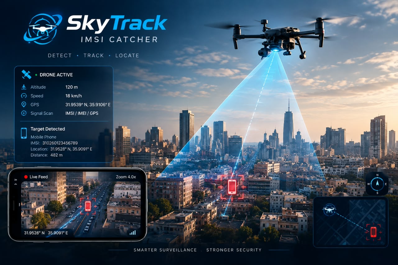
• Tactical Mapping: Real-time GIS map plotting showing the drone's flight path alongside calculated target signal hotspots.
• Live Video Feed: Split-screen orientation displaying the payload's data alongside the drone’s optical or thermal camera feed.
• IMSI Log Dashboard: A live-updating matrix displaying caught IMSI numbers, signal strengths, network types, and time stamps for post-mission forensic analysis.
For further inquiries, detailed information, product videos, or to request the technical specification datasheet in PDF format, please contact us directly via our website's official email address.
The SkyTrack Drone-Mounted Cellular Intelligence & Tracking System is an advanced airborne tactical solution designed to search, track, and precisely locate mobile phones by identifying their unique International Mobile Subscriber Identity (IMSI) numbers. By combining cell-site emulation with the mobility of professional unmanned aerial vehicles (UAVs), this tactical payload provides defense, law enforcement, and search and rescue (SAR) teams with an elite aerial reconnaissance tool that operates independently of commercial network infrastructure.
Tactical Operational Methodology
The SkyTrack payload operates as a localized, high-efficiency aerial cellular base station. When deployed over a target area, it creates a tactical cell environment that encourages target mobile devices to register with the drone platform.
• Interception and Identification: The system automatically captures the unique IMSI and IMEI identifiers of all active mobile phones in its operational radius.
• Geolocational Pinpointing: By combining signal strength analytics with the drone's onboard GPS/BDS navigation data, the system calculates the exact geographical coordinates of the target.
• Real-Time Filtering: Collected data is instantly cross-referenced against customizable Whitelists and Blacklists to trigger automatic tactical alerts when a target device is acquired.
Technical Specifications and Capabilities
• Full-Spectrum Network Support: Fully compatible with all global telecommunication standards, including Legacy GSM (2G), UMTS (3G), LTE (4G), and Next-Gen 5G networks.
• Seamless Gimbal Integration: Engineered as a quick-release tactical payload explicitly compatible with enterprise drone platforms (e.g., DJI Matrice 300/350 RTK), allowing for deployment ready-to-fly in seconds.
• Extended Operational Range: Utilizes the drone's native long-range data transmission links to allow ground operators to control and monitor the payload from up to 15 kilometers away.
• Extreme Penetration Performance: Detects and tracks mobile devices from an airborne altitude of up to 200 meters, with the radio frequency capability to penetrate up to 6 meters underground or through dense structural concrete.
• High-Density Mass Processing: Features high-throughput processing architecture capable of harvesting and logging data from up to 400 terminal devices per minute.
• Pinpoint Sub-Meter Accuracy: Achieves a highly precise localized location boundary of up to 10 meters when operating independently, which refines to less than 1 meter when synchronized with ground-based hand-held direction finders.
• Dual Software-Defined Radios: Equipped with two independent, software-defined radio channels that allow operators to scan two entirely separate service provider networks or frequency bands simultaneously.
• Optimized Power Management: Engineered for minimal power draw, preserving drone battery life to ensure an active mission flight time exceeding 30 minutes per battery cycle.
Strategic Application Scenarios
Search and Rescue Missions
During natural disasters—such as earthquakes, avalanches, landslides, or deep-woods disappearances—SkyTrack acts as a life-saving tool. It can rapidly survey vast, impassable terrains to find trapped or missing victims via their mobile phones, even if those devices are buried deep beneath rubble, snow, or dense forest canopies where human search parties cannot reach.
Law Enforcement and Tactical Surveillance
For national security, border patrol, and police operations, SkyTrack provides a massive tactical advantage. By flying a 360-degree orbit around urban structures, it minimizes RF propagation loss and bypasses building line-of-sight blocks. Ground teams can instantly map out the location of barricaded targets or blacklisted suspects the moment their phone is powered on.
Mission Control Software Interface
The system is controlled via a centralized, intuitive interface installed on the drone's remote controller or an external tactical tablet. The software consolidates critical data into a single, unified viewport:
• Tactical Mapping: Real-time GIS map plotting showing the drone's flight path alongside calculated target signal hotspots.
• Live Video Feed: Split-screen orientation displaying the payload's data alongside the drone’s optical or thermal camera feed.
• IMSI Log Dashboard: A live-updating matrix displaying caught IMSI numbers, signal strengths, network types, and time stamps for post-mission forensic analysis.
For further inquiries, detailed information, product videos, or to request the technical specification datasheet in PDF format, please contact us directly via our website's official email address.